Uncategorized
api to graffiti data
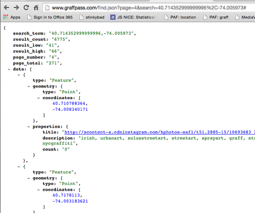
I made an effective low fidelity API to the graffiti data.
You can now query with a location and get back results in chunks of 25. You can page through the results via the page attribute.
I’m conscious that there is currently no key/secret pass system. I have what I need for the application feed, so I’ll go from here.
http://www.graffpass.com/find.json?page=4&search=40.714352999999996%2C-74.005973
Deciding where to focus attention
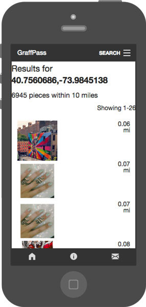
I set up http://www.graffpass.com/find today. Its a way for people to find the graffiti that is closest to them, based on a pool of instagram photos I scraped over two weeks.
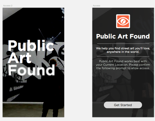
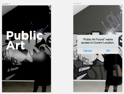
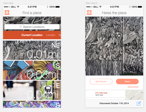
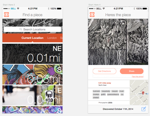
This is an concept experiment for a iPhone app I want to finish next week.
The application currently has a feature for users to find images using two mechanism: type a location or check against current location. When users check against their current location, I am using the browser’s geolocation API to track a person/device’s location.
I am trying to figure out how I want to move forward with this project. Instead of spreading myself too thin, Im considering focusing my attention on a city-by-city launch. Because I dont know the best cities to focus on, Im tracking the use of the “My Location” button.
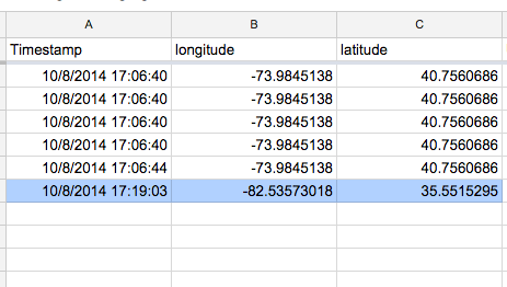
Instead of building out a way for data to be saved off this service, I am using a very low fidelity database: Google Drive. After finding a wiki on “How to write to Google Docs using JavaScript”, I implemented a quick javascript function to save each location check result.
It is not the critic who counts; not the man who points out how the strong man stumbles, or where the doer of deeds could have done them better. The credit belongs to the man who is actually in the arena, whose face is marred by dust and sweat and blood; who strives valiantly; who errs, who comes short again and again, because there is no effort without error and shortcoming; but who does actually strive to do the deeds; who knows great enthusiasms, the great devotions; who spends himself in a worthy cause; who at the best knows in the end the triumph of high achievement, and who at the worst, if he fails, at least fails while daring greatly, so that his place shall never be with those cold and timid souls who neither know victory nor defeat.
T. Roosevelt
Excerpt from the speech “Citizenship In A Republic” delivered at the Sorbonne, in Paris, France on 23 April, 1910
Excerpt from the speech “Citizenship In A Republic” delivered at the Sorbonne, in Paris, France on 23 April, 1910
/2014/10/07/it-is-not-the-critic-who-counts-not-the-man-who/
Graffpass: Your graffiti compass
After pulling streetart and graffiti tagged pictures on Instagram, I quickly realized how unmanageable the pictures were becoming. I was gathering approximately 20,000 pictures a day and didn’t have an effective way of browsing them. There were too many pictures for the traditional ‘grid’ layout design. Since they were pictures, there weren’t too many other ways to show them in bulk.
Based on the sheer amount of data, I explored various ways of filtering the images to increase the percentage of getting an actual picture of graffiti (rather then of something else that was tagged streetart or graffiti). Once I started filtering pictures that were tagged with geo location, I quickly found an improvement in results.

Having more than 200,000 images in my database, I looked for ways to break the image set into smaller chunks. This is where I came up with the idea of using location. When I created the map app that reoriented itself every time a new graffiti picture was uploaded to Instagram with geolocation, I was surprised by the number of people who take pictures of graffiti around the world.
Instagram’s APIs dont allow users to make multi-dimensional queries. They have endpoints for hashtag, location, or user searches, but you can’t do them on top of each other. This prevents any searches that use two of the endpoints together. For example, you can’t search for all the hashtag results in a certain geographic area.
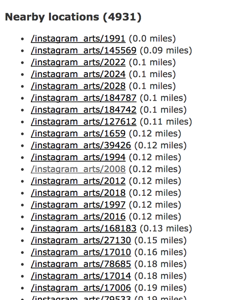
By pulling all of the streetart and graffiti pictures and referencing the results on my own server, I have been able to add additional dimensions of queries onto the hashtag search results. This allows me to do interesting things like find all the other pictures hash-tagged graffiti that are in the same area. In my current case, I can compare a user’s current location to the database of images. This allows me to surface search results that a user can actually go see/find themselves.
The basis of this project is the scraped data that I got through the past few weeks of experimentation. The next part is the mobile interface that makes the search result discovery process relevant to a person who is out and about.
I have a web interface that I can build using a user’s location api in the browser. This is useful, but my end goal is not the graffiti compass. I am simply going through the steps needed to develop a community of people who will document and share graffiti themselves. This is not something that I can start out doing from scratch. The existing Instagram pictures provide me with the astroturfed platform for people to willingly contribute to.
Physical Web

I can’t help to see the similarities of Graffiti discovery and new Beacon technology usage. In detecting and using a public smart device, a Beacon announces to a receiver. If the receiver, such as a cellphone, is looking for the Beacon, it can allow instant interactions with the device.
In discovering Graffiti, a person using their eyes recognizes an intentionally created public art piece. With the sheer number of pictures being taken of Graffiti at any moment, I think there is a place for tools that help detect Graffiti using digital mediums.
Approximately every 2 seconds, a new picture tagged with streetart or graffiti is posted on Instagram. Out of those pictures, about 40-60% contain geotagged meta data. Using this data on a massive scale, a cell phone could be used as a digital Graffiti detection tool.
Google released a github repository today called “Physical Web”. The repository contains a prototype for an Android Beacon detection app.

The app discusses the need for digital interactions that don’t require apps. They state:
“People should be able to walk up to any smart device: e.g. a vending machine, a poster, a toy, a bus stop, a rental car, and not have to download an app first in order to use it”.
Im going to be watching this project closely.